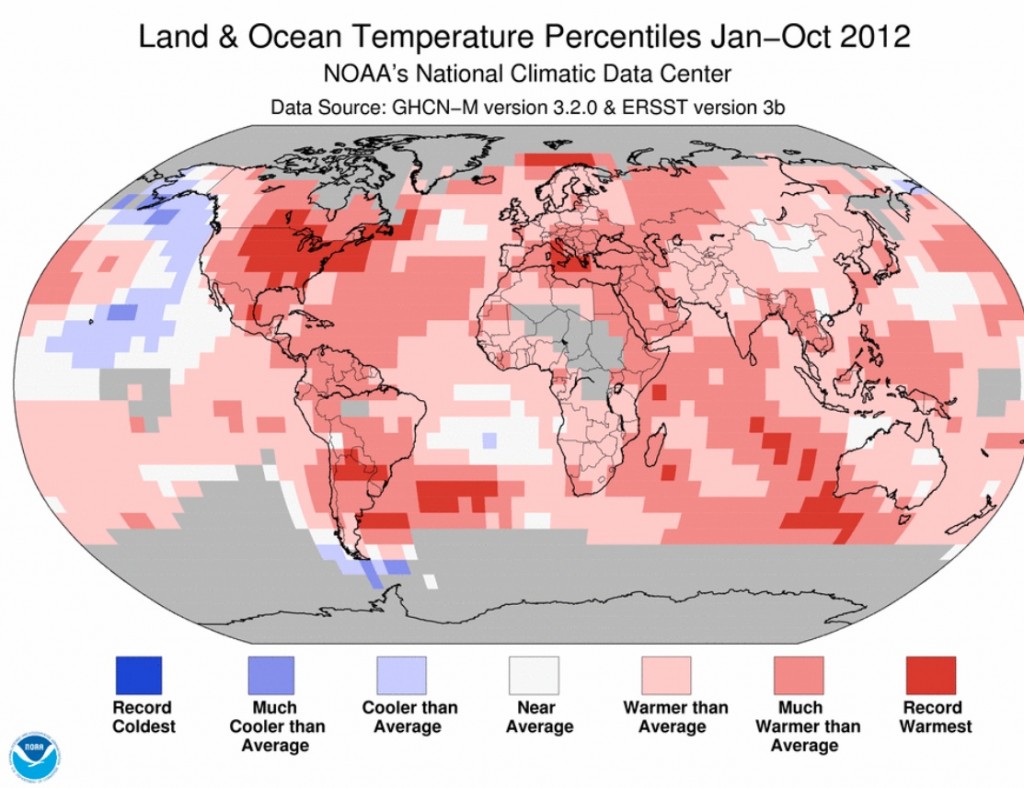
The following map is one of the more telling ones we have seen related to global warming. Of particular note for us in Nova Scotia is the large area of Record Warmest that sits over the central and eastern United States and extends north across the Gulf of Maine into Nova Scotia’s land and water bodies. This warm water edge may have had an influence on the power and direction of hurricane Sandy. In any case, it has an impact on our microclimate along the coast.
The Town of Yarmouth is involved in development of a Climate Change Action Plan. It is nice to see leadership thinking ahead to what may be down the road. Members of TREPA are involved in this planning process.

